Order Catalogue
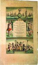
Plotting the Oceans: Dutch Sea Atlases of the Seventeenth Century features a selection of hand-coloured sea charts from the golden age of Dutch cartography - the Fisher Library copies of the 1666 sea atlas of Hendrik Doncker and the 1686 atlas of Jacobus Robijn. The exhibition, by Anne Dondertman, begins with a brief look at the Mediterranean manuscript chart tradition and gives an overview of the evolution of navigational charts, placing the Dutch chart trade in the context of the age of discovery and exploration. The exhibition then continues with examples from the Doncker and Robijn atlases, often showing charts of the same area from the two atlases side by side in order to compare and contrast their portrayal of the area, as well as to point out relevant facts of their publishing history.
Plotting the Oceans: Dutch Sea Atlases of the Seventeenth Century
ISBN 0772760330, 16 pages, $5.00 | Ref. #7001
